Illustrated · 1 min
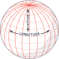
Below is a picture of one side of the Earth (approximately a sphere), with "horizontal" latitudinal lines (running in the East-West direction, at a constant North/South angle) and "vertical" longitudinal lines (running in the North-South direction, at a constant East/West angle) drawn in. Together, the lines form a "grid of spherical rectangles" (except at the North and South poles, where instead we have "spherical triangles").