
Interactive · 3 questions
+3 contributors

Standing on the North Pole
In most places on Earth, your longitude and latitude are like and coordinates in the plane (as long as you don't go too far, of course, because then you start noticing that the world is not flat).
What if you're standing on the North Pole? A map of parallels and meridians would look like this (with you at the center):

Knowing the latitude of a point close to you puts it on one of the circles, telling you how far away it is. Knowing the longitude of a point puts it on one of the lines, telling you which direction it's in. It's still true, of course, that latitude and longitude together specify a point uniquely; they just do it in a way we're not used to!
Polar coordinates
We can extend this to a mathematical notion of specifying a point on a plane, not by its and coordinates, but by its distance from the origin, , and its "direction", .
What is , exactly? It's an angle measure ranging from to radians (or from to , but degree measures are very rarely used for this) telling you how far counterclockwise you are from the positive -axis.
The and coordinates of a point are called "polar coordinates".
Here are some examples:
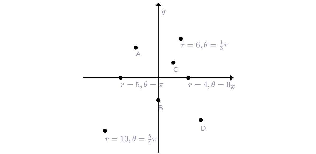
Which of these lists puts , , , and in order of increasing ?
Which of these points has ?
What is for the point ?